
19 Aug Best Mountaineering Expeditions in India
About climbing in India
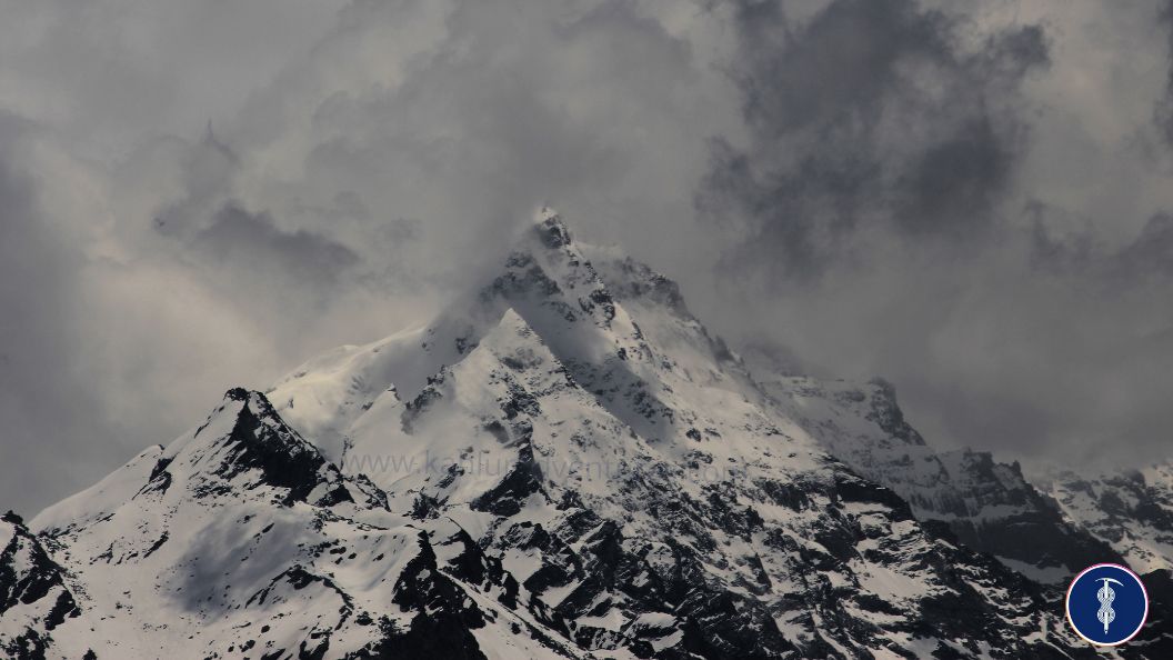
‘You are not in the mountains. The mountains are in you.’ The Mountains of India, India has been the hotspot for mountaineers for a long time, The Mountains of India offer you to climb above 5000 M, 6000 M and 7000 M peaks which makes it ideal for Technical or non-technical excursions. The states of Jammu and Kashmir union territory, Ladakh UT, Himachal Pradesh, Sikkim, Arunachal Pradesh and Uttarakhand are among the most popular hill destinations in India. Peak climbing in India is also preferred by climbers as they provide a unique and vibrant culture for the locals. Trek to these peaks takes you across local, remote areas and villages, and allows you to communicate, and experience their lives.
‘With climbing in Indian Himalayas, you can also choose to climb the 5000M, 6000M and 7000 M Mountains, The Mountains of India are also the first choices of those climbers who want to climb the 14 above 8000M (Mount Everest, Kanchenjunga, Nanga Parbat, etc). Most of the mountains of India are climbed between May – Mid December. Climb the above 7000M peak in Ladakh UT Mount Nun 7135, Mount Kun 7077, Friendship peak 5289M, Hanuman Tibba 5490M, Deo Tibba 6001M Expedition in Manali Himachal Pradesh, Mount Satopanth 7075M, Mount Shivling 6543M and Tenchenkhang 6010 M, in Sikkim Himalayas, Gorichen Peak 6526M mountain in Eastern Himalayas Sikkim. All the summit of these mountains treats you to some breathtaking views of the picturesque beauty of the Indian Himalayas.
Read the full article to get the full knowledge of top climbing expeditions in the Indian Himalayas.
Note: Climbers, from India or International both need to apply to the IMF (Indian Mountaineering Foundation) for permits before embarking on an expedition in India. Every foreign climbing expedition will be required to be accompanied by an Indian LO appointed by the IMF. The LO (Liaison Officer) will be treated as a member of the expedition.
*HAVE A LOOK AT THE LIST OF 11 BEST PEAK CLIMBING EXPEDITIONS IN INDIA, AND THEN SELECT THE ONE THAT WORKS BEST FOR YOU.
01) Mount Nun 7135M Ladakh (UT) India:
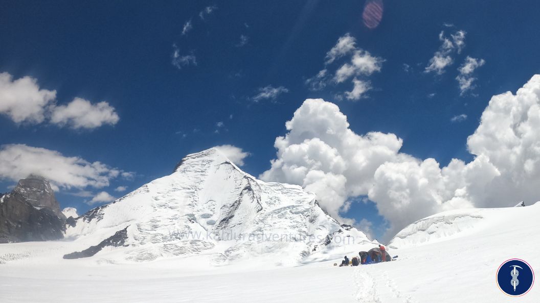
The highest peak in the Nun Kun massif, Mount Nun expedition 7135M India. Climbing above 7000M and for the best technical peaks experience, Nun peak is the first choice of mountaineers. The massif Nun – Kun is located in Suru valley of the Kargil district Ladakh UT. The first ascent of Mount Nun peak was in 1953 by a French climber Mr Pierre Vittoz, and Mrs Claude Kogan along with the India Sherpa team.
Route to Climb Mount Nun: Delhi – Leh Ladakh – Kargil – Tangol – Basecamp – Camp 01 – Camp 02 – Summit Camp – Summit Mt Nun 7135M – Camp 01 – Base camp – Kargil – Leh Ladakh – Delhi
The entire expedition requires good, advanced technical skills or previous experience, the expedition takes a minimum 25, 27 (Delhi to Delhi) days to climb.
Things to Know About Mt Nun Expedition India:
| Country/ Region | India/ Leh Ladakh UT - Kargil |
|---|---|
| Altitude | 7135M / 23408.79FT |
| Duration | 23 Days Minimum (Delhi – Delhi) |
| Climbing Face | North Face |
| Grade | Difficult/ Technical |
| Best Time to Climb Mt Nun | July to August |
| Trekking Km | 60 - 65 KM |
| Coordinates | 33.9817° N, 76.0231° E |
| Mountain Range | Zanskar range |
| Last ATM place | Kargil |
| Nearest Airport | Leh Airport and Srinagar Airport |
| Road head | Tangol (Kargil) last village |
| Mobile connectivity In mount Nun expedition India | Only for Postpaid JIO or BSNL network till the Tangol village or you get a little signal in some point of Base camp and camp 02 |
| Duration of Base camp | 01 Days (7-8 hrs Trek) |
| Local police station contact | 01985 – 233948 (Kargil) |
| Local hospital contact | 01985- 232213 (Kargil) |
| Local guide contact for Nun expedition | +91 8588846600 (Call + WhatsApp) 24*7 work |
| Note | Satellite phone is prohibited in this area |
02) Mount Kun 7077 M Ladakh (Ut) India:
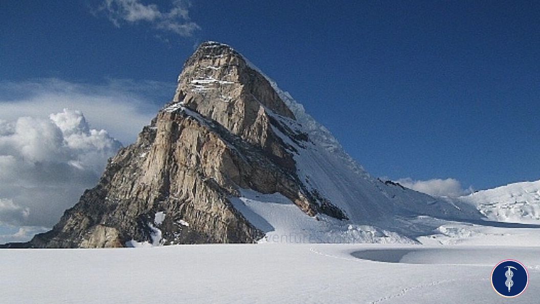
The Nun Kun mountain massif is a pair of Himalayan peaks: Nun, 7,135 m (23,409 ft) and its neighbour peak Kun Peak, 7,077 m (23,218 ft). Mount Kun 7077M is one of the highest peaks of Suru valley Kargil/ Ladakh (UT) India, which is located in the Zanskar range of the Himalayas. Mt. Kun is located north of Nun and is separated from it by a snowy plateau around 5-6 km. NunKun Massif Mountain is considered a part of the greater Himalayan Range Zanskar. Mount Kun and Mt Nun are just a few miles apart, although they have entirely different routes to climb. Kun peak India was first successfully climbed in 1913 by Italian climbers Borelli ed Gaspard and Mario Piacenza. After that in 1971 Indian army summited the top of Mount Kun. Every year more than 5, 6 six climbing teams (National or International) come to the summit. Mount Kun is a technical peak that requires your pre-experience in the field of climbing expeditions. To get the climbing permit Indian climbers need to submit their Basic or advanced course of Mountaineering to the Indian Mountaineering Foundation (IMF) and International climbers need to apply for booking at least three months before and send their Passport or Visa copy. The entire expedition requires good, advanced technical skills or previous experience, the expedition takes a minimum of 25, 27 (Delhi to Delhi) days to climb.
Route to Climb Mount Kun: Delhi – Leh Ladakh – Kargil – Shafat Nala– Basecamp – Camp 01 – Camp 02 – Summit Camp – Summit Mt Kun 7077 M – Camp 01 – Base camp – Shafat Nala – Kargil – Leh Ladakh – Delhi
Things to Know About – Mt Kun Expedition India:
| Country/ Region | India/ Leh Ladakh UT - Kargil |
|---|---|
| Altitude | 7077 M / 23218.504 FT |
| Duration | 23 Days Minimum (Delhi – Delhi) |
| Climbing Face | North Face |
| Grade | Difficult/ Technical |
| Best Time to Climb Mt Kun | July to September |
| Trekking Km | 32 KM |
| Coordinates | 34.0133° N, 76.0566° E |
| Mountain Range | Zanskar range |
| Last ATM place | Kargil |
| Nearest Airport | Leh Airport and Srinagar Airport |
| Road head | Shaft Nala (Kargil) last village |
| Mobile connectivity In mount Kun expedition India | Tangol village is the last village for the call. Network (BSNL and JIO) |
| Duration of Base camp | 01 Days (7-8 hrs Trek) |
| Local police station contact | 01985 – 233948 (Kargil) |
| Local hospital contact | 01985- 232213 (Kargil) |
| Local guide contact for Kun expedition | +91 8588846600 (Call + WhatsApp) 24*7 work |
| Note | Satellite phone is prohibited in this area |
03) Kang Yatse II Peak Expedition Ladakh India:
Mount Kang Yatse is the less known peaks of two massifs, both the peaks are above 6000 M. Kang Yatse II, at 6,250M Kang Yatse I 6,400M. Mt Kang Yatse is located in the land of high passes Leh Ladakh, in Hemis National Park. It takes 05, and 06 days to reach the basecamp of Mt Kang Yatse through Markha Valley. Most of the trekkers come to Kang Yatse after the Markha valley trek to get the buy one get one free offer. Mount Kang Yatse II is the non-technical peak; it’s required only for your excellent physical fitness. That’s why so many trekkers come to summit the above 6000m peak. Some climbers come to the summit of Kang Yatse for acclimatization after that they go climbing the above 7000 M peak of mount Nun or mount Kun.
Route To Climb Mount Kang Yatse 2: Delhi – Leh – Chilling – Skiu – Markha – Thachungtse – Nimaling – Base Camp – Summit Mt KANG YATSE II – Base Camp – Chokdo via Kongmaru La – Leh
Things to Know About Mt Kang Yatse II Expedition India:
| Country/ Region | India/ Leh Ladakh UT - Kargil |
|---|---|
| Altitude | 6250M / 20505.25FT |
| Duration | 15 Days Minimum (Delhi – Delhi) |
| Climbing Face | North-East ridge |
| Grade | Moderate (Semi-Technical) |
| Best Time to Climb Mt Kang Yatse II | July to September |
| Trekking Km | 75 - 80 KM |
| Coordinates | 33°44′54″N 77°33′25″ |
| Mountain Range | Ladakh Mountain Range |
| Last ATM place | Leh |
| Nearest Airport | Leh Airport and Srinagar Airport |
| Road head | Chilling |
| Mobile connectivity In mount Kang Yatse II expedition India | Postpaid JIO or BSNL network will work in some places during trek . |
| Duration of Base camp | 06 Days |
| Local police station contact | 01982 252 200 (Leh) |
| Local hospital contact | +911982252012 (Leh) |
| Local guide contact for Kang Yatse II expedition | +91 8588846600 (Call + WhatsApp) 24*7 work |
| Note | Satellite phone is prohibited in this area |
04) Friendship Peak (5289M) Trek Manali Himachal Pradesh India:
Friendship peak is a mountain of 5,289 meters altitude located in the Pir Panjal Range of Kullu district Himachal Pradesh. Friendship peak trek is an ideal trek for the first step in the technical climbing mountains. Mount friendship peak expedition is the ideal peak for beginner climbers. It’s a Semi-Technical peak that requires physical fitness and Basic knowledge of trekking equipment. You will get the panoramic summit views of Mt Indrasen, Deo Tibba, Shitidhar, Hanuman Tibba and the distant Dhauladhar range. The trek initially is a simple hike through meadows and forest with the Beas River flowing beside. The Base camp of the Mount friendship is at Bakarthach. From Bakarthach you get a clear view of seven sister mountains and Mount Hanuman tibba. In the Basecamp of friendship peak (Bakarthach), you will also get the opportunity to meet with a young mountaineer who is doing the Basic or Advanced courses of Mountaineering with Atal Bihari Vajpayee Institute of Mountaineering and Allied Sports (ABVIMAS). Friendship peak in Manali, Himachal Pradesh also famous for skiing down expeditions, Ski down from above 5000M peak give a unique experience for ski lovers, Mid March is the best time for the ski down from Mount friendship peak India.
Route to Climb Mount Friendship peak: Delhi – Chandigarh – Manali – Dhundi (Via Solnag) – Bakarthach (BC) – Lady Leg – Camp 1 – Summit – Bakarthach (BC) – Dhundi – Manali – Chandigarh Delhi
Things to Know About: Mt Friendship Peak Expedition India:
| Country/ Region | India/ Manali Himachal Pradesh |
|---|---|
| Altitude | 5289M / 17.35236FT |
| Duration | 13 Days Minimum (Delhi – Delhi) |
| Climbing Face | South face |
| Grade | Moderate (Semi-Technical) |
| Best Time to Climb Mt Nun | March, May, June, September, October |
| Trekking Km | 30 - 35 KM |
| Coordinates | 32.3960° N, 77.1030° E |
| Mountain Range | Pir Panjal range |
| Last ATM place | Manali |
| Nearest Airport | Kullu (Bhuntar Airport) |
| Road head | Dhundi/ Solang |
| Mobile connectivity In mount Mount Friendship India | JIO, BSNL and Airtel network will work in some places during the trek. You also get the signal at the summit point Network. |
| Duration of Base camp | 01 Days (4 - 5 hrs Trek) |
| Local police station contact | 01902 252 326 (Manali) |
| Local hospital contact | 1902223077 (Manali) |
| Local guide contact for Friendship peak | +91 8588846600 (Call + WhatsApp) 24*7 work |
| Note | Satellite phone is allowed in this area |
05) Mount Deo Tibba (6001M) Expedition India:
Climb the second highest peak of the Pir Panjal range Mt Deo Tibba. The trek to the base camp starts from the Jagatsukh Nala. Deo Tibba peak is a popular mountain for intermediate mountaineers with some technical experience; this peak is ideal for trekkers who are starting out in the mountaineering/Climbing field. The first ascent of Mount Deo tibba peak was in 1952 by Dutchman Van Graaf from the west ridge. It’s a three days trek to reach the basecamp of Deo tibba peak, Deo tibba peak in India is religious as it is believed to be the assembly place of all the Gods. Deo tibba expedition Manali Himachal Pradesh is perfect for climbers to summit the height of 6000M+ and prepare themselves for higher climbing peaks in the near future.
Things to Know About: Mount Deo Tibba 6001m Peak Expedition India:
| Country/ Region | India/ Manali Himachal Pradesh |
|---|---|
| Altitude | 6001M / 19.68832FT |
| Duration | 16 Days Minimum (Delhi – Delhi) |
| Climbing Face | West ridge |
| Grade | Moderate (Semi-Technical) |
| Best Time to Climb Mount Deo Tibba | March, May, June, September, October |
| Trekking Km | 40 - 45 KM |
| Coordinates | 32.1975° N, 77.3825° E |
| Mountain Range | Pir Panjal range |
| Last ATM place | Manali |
| Nearest Airport | Kullu (Bhuntar Airport) |
| Road head | Khanol |
| Mobile connectivity In Mount Deo Tibba expedition India | No Network |
| Duration of Base camp | 03 Days |
| Local police station contact | 01902 252 326 (Manali) |
| Local hospital contact | 1902223077 (Manali) |
| Local guide contact for Mount Deo Tibba | +91 8588846600 (Call + WhatsApp) 24*7 work |
| Note | Satellite phone is allowed in this area |
06) Mt. CB 13 and CB 14 Peak Climbing Expedition, Manali Himachal Pradesh India
Mount CB (Chandra Bhaga) is a group of peaks locatin ed in the Lahaul massif Himachal Pradesh India, Mount. CB 13 (6264M) and Mount. CB 14 (6078M) is two massif peaks near the beautiful Chandratal Lake near Batal. CB 13 and CB 14 peaks require pre-riencednced climbers who want to go to the next level and experience an exciting journey to the summit. The summits of these two beautiful peaks give you amazing and panoramic views of the Kunzum range, the ChandraTal Lake and the gushing Chandra River. To climb both the peak also comes under the IMF (Indian Mountaineering Foundation) so you also need to pre-book the expedition to get the permit.
Things to Know About: Mt. CB 13 And CB 14 Peak Expedition India:
| Country/ Region | India/ Spiti Himachal Pradesh |
|---|---|
| Altitude | Mt.CB 13 (6264M) and Mt. CB 14 (6078M) |
| Duration | 20 Days Minimum (Delhi – Delhi) |
| Climbing Face | North-East |
| Grade | Technical |
| Best Time to Climb Mount CB 13 or 14 | June & August |
| Trekking Km | 25 - 30 KM |
| Coordinates | 77° 33' N / 32° 21' E ` |
| Mountain Range | Chandra Bhaga |
| Last ATM place | Manali |
| Nearest Airport | Kullu (Bhuntar Airport) |
| Road head | Batal |
| Mobile connectivity In Mount CB 13 or 14 expedition India | No Network |
| Duration of Base camp | 01 Days |
| Local police station contact | 01902 252 326 (Manali) |
| Local hospital contact | 1902223077 (Manali) |
| Local guide contact for CB 13,14 expedition | +91 8588846600 (Call + WhatsApp) 24*7 work |
| Note | Satellite phone is allowed in this area |
07) Mt. Shivling (6543M) Climbing Expedition, Gangotri Uttarakhand, India
Mount Shivling Peak Expedition India is a twin summit mountain. Mt Shivling is also considered one of the most challenging peaks in the Indian Himalayas. Mt Shivling is located in the Gangotri national park of Garhwal Himalayas. The lush green meadows of Tapovan are the base camp of Mount. Shivling peak is one of the most famous treks in Uttarakhand. Climbers, from India or International both need to apply to the IMF Indian Mountaineering Foundation) for permits before embarking on an expedition in India.
“I still remember the physical reaction of turning the corner and seeing Shivling for the first time. Jaw dropped, eyes wide, heart pumping. The truly stunning beauty of granite and ice. Still on the shortlist. Garwhal Himalayas, India” Jimmy Chin
Things to Know About: Mt. Shivling 6543m Peak Expedition India:
| Country/ Region | India/ Gangotri Uttarakhand |
|---|---|
| Altitude | 6543M, 21466.54FT |
| Duration | 20 – 25 Days Minimum (Delhi – Delhi) |
| Climbing Face | West Ridge, North Face |
| Grade | Technical |
| Best Time to Climb Mount Shivling | May, June, September & October |
| Trekking KM | 55 - 60 KM |
| Coordinates | 30.8769° N, 79.0656° E |
| Mountain Range | Garhwal |
| Last ATM place | Uttarkashi |
| Nearest Airport | Jolly Grant International Airport - Dehradun |
| Road head | Gangotri |
| Mobile connectivity In Mount Shivling expedition India | No Network |
| Duration of Base camp | Gangotri |
| Local police station contact | 01374 222 219 (Uttarkashi) |
| Local hospital contact | 01374 222 103 (Uttarkashi) |
| Local guide contact | +91 8588846600 (Call + WhatsApp) 24*7 work |
| Note | Satellite phone is allowed in this area |
08) Mount Satopanth 7075M Climbing Expedition, Gangotri Uttarakhand, India
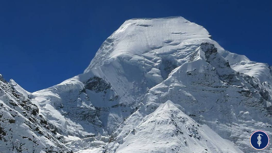
Climb the second highest mountain of the Gangotri group of peaks in Garhwal, Uttarakhand, Interested to climb above 7000M peak, book your expedition to Mt Satopanth peak 7075M India. Mt Satopanth which means “True Path” in local beliefs. The trekking trail for Mt. Satopanth base camp crosses through the Gangotri temple (holy places among the four Char Dham Yatra), and Gaumukh (source of the holy Bhagirathi River). Mount Satopanth is also the first choice of the climbers who want to climb Mount Everest above 8000 M peak, they come to embark on Satopanth peak as a pre-Everest expedition. During the trek to the Satopanth peak, you get the viws of Thalay Sagar peak, Mt. Shivling ,and the Bhagirathi group of mountains.
Things to Know About: Mt. Satopanth 7075m Peak Expedition India:
| Country/ Region | India/ Gangotri Uttarakhand |
|---|---|
| Altitude | 7075M, 23211.94FT |
| Duration | 20 – 25 Days Minimum (Delhi – Delhi) |
| Climbing Face | North Face |
| Grade | Technical |
| Best Time to Climb Mount Satopanth | May, September & October |
| Trekking Km | 75 - 80 KM |
| Coordinates | 30°5028 N 79°1249 E |
| Mountain Range | Garhwal |
| Last ATM place | Uttarkashi |
| Nearest Airport | Jolly Grant International Airport - Dehradun |
| Road head | Gangotri |
| Mobile connectivity in mount Satopanth Peak India | No Network |
| Duration of Base camp | 05 Days |
| Local police station contact | 01374 222 219 (Uttarkashi) |
| Local hospital contact | 01374 222 103 (Uttarkashi) |
| Local guide contact for Mount Satopanth expedition | +91 8588846600 (Call + WhatsApp) 24*7 work |
| Note | Satellite phone is allowed in this area |
09) Mount Kedardome 6831M Climbing Expedition, Gangotri Uttarakhand, India:
Mount Kedardome climbing peak expedition located in the Garhwal range of Indian Himalayas near to the Bhagirathi group of mountains, Mt Shivling, Mount Satopanth and Gangotri massif. This high dome-shaped peak has an altitude of 6,832M; the Kedar Dome peak in India is the third-highest peak in the Gangotri group of mountains in Uttarakhand India. Mount Kedardome is the ideal stepping peak to climb above 7000m. Mount Kedar dome peak in India It is also popular for ski-mountaineering. Mt. Kedardome passes the area of Chirbasa, Bhojwassa, Gomukh and Tapovan. During the trek to the Mount Kedardome base camp, you will witness some of the most beautiful as well as challenging peaks in the Gangotri region (Bhagirathi Group of mountains, Mount. Shivling, Meru peak India, Mt Kharchakund etc. Kedardome peak is ideal for ski ascents and is popular amongst skiers around the world.
Things to Know About Mt. Kedardome 6831m Peak Expedition India:
| Country/ Region | India/ Gangotri Uttarakhand |
|---|---|
| Altitude | 6831M, 22411.42FT |
| Duration | 20 – 25 Days Minimum (Delhi – Delhi) |
| Climbing Face | Northwest Face |
| Grade | Technical |
| Best Time to Climb Mt Kedardome | Mid March, April, September & October |
| Trekking Km | 60 - 75 KM |
| Coordinates | 30.7975° N, 79.0675° E |
| Mountain Range | Garhwal |
| Last ATM place | Uttarkashi |
| Nearest Airport | Jolly Grant International Airport - Dehradun |
| Road head | Gangotri |
| Mobile connectivity in mount Mount Kedardome India | No Network |
| Duration of Base camp | 04 Days |
| Local police station contact | 01374 222 219 (Uttarkashi) |
| Local hospital contact | 01374 222 103 (Uttarkashi) |
| Local guide contact for Mount Kedardome | +91 8588846600 (Call + WhatsApp) 24*7 work |
| Note | Satellite phone is allowed in this area |
10) Mount. Tenchenkhang 6010M Climbing Expedition, Sikkim, India:
Sikkim shares a mountain border with Nepal, China. Sikkim (Where Nature Smiles) a beautiful state in India remains unrivalled when it comes to the amazing experience of mountain climbing. Recently Sikkim was also introduced as a mountaineering destination. The Sikkim Government has opened some of its climbing peaks to adventure lovers. Top Peaks in Sikkim Himalayas Region Frey Peak 5889M, Mt. Jopuno 5603M, Mount. Lama Wangden 5868M, Brumkhangse Peak 5868M, Mount. Tenchenkhang 6010M. is situated in the western part of Sikkim, under Kanchenjunga National. Thinchenkhang peak has been declared a trekking peak by Sikkim Govt in 1990. The trek to the Tenchenkhang passes through the Beautiful Remote Villages Yuksom. During the trek to the Mount Thinchenkhang base camp you will witness some of the most beautiful as well as challenging peaks in Sikkim (Khangchendzonga National Park), Mount Kanchenjunga 8586M, Mt Talung 7349M, Mt. Rathong 6679M, Mt. Koktang6147M, Mt. Simvo 6812, Mount. Frey 5853M, Mt. Kabru S 7318M, Kabru Dome 6600M, Kabru Forked 6100M, Mount Pandim 6691M, Mount Tenchenkhang6010M, Mount Jupono 5650M.
Things to Know About Tenchenkhang 6010m Peak Expedition India:
| Country/ Region | India/ Sikkim |
|---|---|
| Altitude | 6010M 19717.85FT |
| Duration | 15 – 20 Days Minimum (Delhi – Delhi) |
| Climbing Face | |
| Grade | Moderate (Semi-Technical) |
| Best Time to Climb Mt Tenchenkhang | May, Sep, Oct, Nov |
| Trekking Km | 60 - 65 KM |
| Coordinates | 27°22'14.7"N 88°13'30.6"E |
| Mountain Range | Chola range |
| Last ATM place | Yuksom |
| Nearest Airport | Bagdogra, West Bengal |
| Road head | Yuksom |
| Mobile connectivity in mount Tenchenkhang Peak India | BSNL and Vodafone in Yuksom |
| Duration of Base camp | 08 Days |
| Local police station contact | 03595 250 819 |
| Local hospital contact | |
| Local guide contact for Mount Tenchenkhang expedition | +91 8588846600 (Call + WhatsApp) 24*7 work |
| Note | Satellite phone is not allowed in this area |
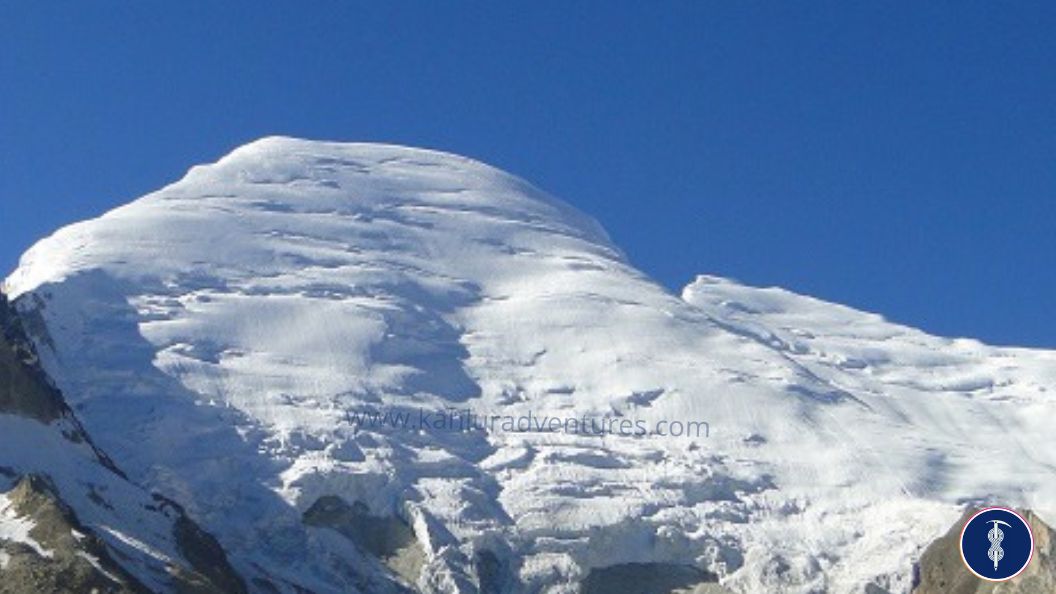
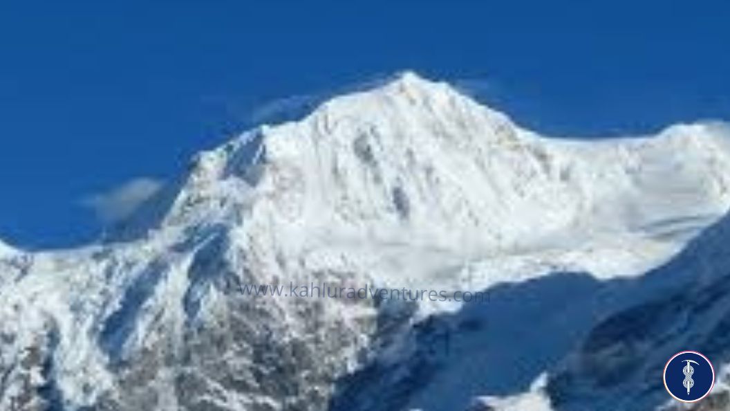
11) Mount Gorichen Peak 6858M Climbing Expedition, Arunachal Pradesh, India
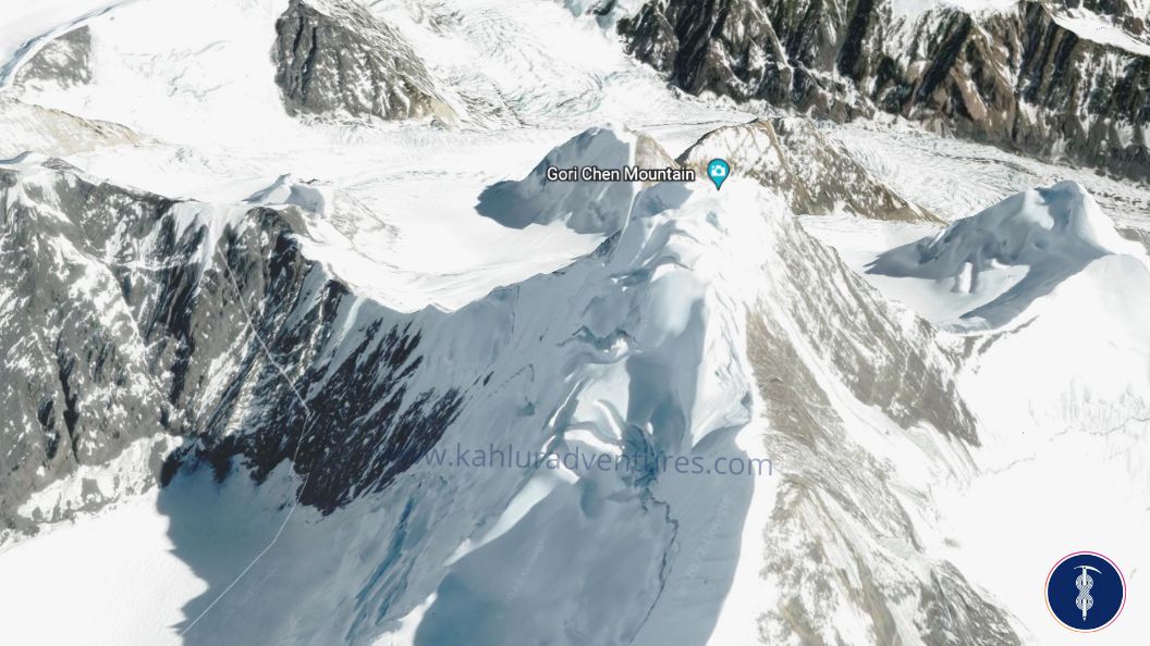
Gorichen is the highest climbing peak in Arunachal Pradesh India, Other peaks include Gorichen II (21,287 feet (6,488 m)), Gorichen East (20,413 feet (6,222 m)) and Gorichen South (20,496 feet (6,247 m)) towering at a height of over ft above ocean position. Because of its elevation, Gorichen remains snowbound throughout the time and has charmed the hearts of numerous seasoned perambulators and adventure-loving pedestrians. Positioned at a distance of 164 km from the main city, this peak is locally known as Tsa-Nga-Phu, which translates into the area of the deity. You can see better views of this peak during the road drive between Bomdila and Tawang. The Monpa lineage worships this peak as they believe it’s vital for their actuality and protects them from all immoralities. Locally, people frequently relate to it as the giant white giant because of the unmistakable, white carpet of snow that covers it, making it one of the most distinctive and fluently identifiable peaks in this region. The view is mesmerizing as there are patches of green meadows and green timbers that can be seen in the interlocking denes below, while the bright white snow-limited peaks palace over them, shining in the sun.
Things to Know About Gorichen 6858m Peak Expedition India:
| Country/ Region | India/ Sikkim |
|---|---|
| Altitude | 6858M 22500FT |
| Duration | 15 – 20 Days Minimum (Delhi – Delhi) |
| Climbing Face | |
| Grade | Moderate (Semi-Technical) |
| Best Time to Climb Mt Gorichen | May, Sep, Oct, Nov |
| Trekking Km | 35 - 40 KM |
| Coordinates | 27.7951496°N 92.3877074°E |
| Mountain Range | |
| Last ATM place | |
| Nearest Airport | |
| Road head | |
| Mobile connectivity in | |
| Duration of Base camp | |
| Local police station contact | |
| Local hospital contact | |
| Local guide contact for Mount Satopanth expedition | +91 8588846600 (Call + WhatsApp) 24*7 work |
| Note | Satellite phone is not allowed in this area |
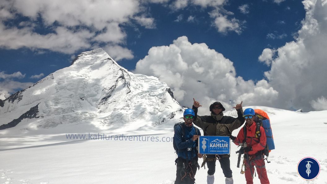
Kahlur Adventures (About us):
About Kahlur Adventures: Plan your next adventure in India with the new startup company “Kahlur Adventure India ” we provide all kinds of logistic support that help climbers to embark on the Mountains of India. Since it’s a new startup we are offering a value-for-money price. We take all the required permits from the local govt authorization as well full expedition acknowledgment letter from IMF (Indian Mountaineering Foundation), and all the equipment including alpine tents are UIAA certified. All our guides and Sherpa are well-certified mountaineers recognized by the govt mountaineering institutes in India.
Note: Kahlur Adventures India will not run any expedition or trek without Insurance.
No Comments